 Also known as "Islas Malvinas", are an archipelago in the South Atlantic Ocean, located about 300 miles (260 nmi; 480 km) from the coast of mainland South America, 700 miles (610 nmi; 1,100 km) from mainland Antarctica, and 3,800 miles (3,300 nmi; 6,100 km) from Africa. The archipelago, consisting of East Falkland, West Falkland and 776 lesser islands, is a self-governing Overseas Territory of the United Kingdom. The capital, Stanley, is on East Falkland.
  The islands were uninhabited when they were first discovered by European explorers, but there is evidence that Patagonian Indians may have reached the Falklands in canoes. A group of islands appeared on maps in the Falkland Island region from the early 16th century, so either Ferdinand Magellan or another early expedition may have sighted them. Amerigo Vespucci may have sighted the islands in 1502, but he did not name them. In 1519 or 1520, Esteban Gómez, a captain in Magellan’s expedition, encountered several islands that members of his crew called "Islas de Sansón y de los Patos" ("Islands of Samson and the Ducks"). These were probably the Jason Islands, northwest of West Falkland, and the names "Islas de Sansón" (or "San Antón," "San Son," and "Ascensión") were used for the Falklands on Spanish maps during this period. Piri Reis, a Turkish admiral of the time who drew reasonably accurate maps, showed islands that may well have been the Falkland Islands.
There is some dispute about which European explorer first set foot on the islands. The islands appear on numerous Spanish and other maps beginning in the 1520s. The English explorer John Davis, commander of the Desire, one of the ships belonging to Thomas Cavendish's second expedition to the New World, is recorded as having visited the islands in 1592. He was separated from Cavendish off the coast of what is now southern Argentina by a severe storm and discovered the islands. For a time the islands were known as "Davis Land". In 1594, the English commander Richard Hawkins visited the islands. Combining his own name with that of Queen Elizabeth I, the "Virgin Queen", he gave them the name of "Hawkins' Maidenland." Many give the credit to Sebald de Weert, a Dutchman, who discovered the islands in 1600.
 In January 1690, Captain John Strong of the Welfare was heading for Puerto Deseado (now in Argentina). Driven off course by contrary winds, he reached the Sebald Islands instead and landed at Bold Cove. He sailed between the two principal islands and called the passage "Falkland Channel" (now Falkland Sound), after Anthony Cary, 5th Viscount Falkland, who as Commissioner of the Admiralty had financed the expedition (Cary later became First Lord of the Admiralty). The island group later took its English name from this body of water.
  The first settlement on the Falkland Islands, named Port St. Louis, was founded by the French navigator and military commander Louis Antoine de Bougainville on Berkeley Sound, in present-day Port Louis, East Falkland in 1764.
 In January 1765, the British captain John Byron, unaware of the French presence, explored and claimed Saunders Island, at the western end of the group, where he named the harbor of Port Egmont. He sailed near other islands, which he also claimed for King George III. A British settlement was built at Port Egmont in 1766. Also in 1766, Spain acquired the French colony, and after assuming effective control in 1767, placed the islands under a governor subordinate to the Buenos Aires colonial administration. Spain attacked Port Egmont, ending the British presence there in 1770. The expulsion of the British settlement brought the two countries to the brink of war, but a peace treaty allowed the British to return to Port Egmont in 1771 with neither side relinquishing sovereignty.
 In 1774, as a result of economic pressures leading up to the American Revolutionary War, the United Kingdom withdrew unilaterally from many of her overseas settlements, including Port Egmont. Upon her withdrawal in 1776 the UK left behind a plaque asserting her claims. From 1776 until 1811 Spain maintained a settlement administered from Buenos Aires as part of the Viceroyalty of the Rio de la Plata. On leaving in 1811, Spain also left behind a plaque asserting her claims.
 On 6 November 1820, Colonel David Jewett raised the flag of the United Provinces of the River Plate (Argentina) at Port Louis. Jewett was an American sailor and privateer in the employment of Buenos Aires businessman Patrick Lynch to captain his ship, the frigate Heroína (Lynch had obtained a corsair license from the Buenos Aires Supreme Director José Rondeau). Jewett had put into the islands the previous month, following a disastrous eight-month voyage with most of his crew disabled by scurvy and disease. After resting in the islands and repairing his ship he returned to Buenos Aires.
  In 1828 the Argentines founded a settlement and a penal colony. United States warships destroyed this settlement in 1831 after the Argentine governor of the islands Luis Vernet seized US seal hunting ships during a dispute over fishing rights. Escaped prisoners and pirates were left behind. In November 1832, Argentina sent another governor who was killed in a mutiny.
In January 1833, British forces returned and informed the Argentine commander that they intended to reassert British sovereignty. The existing settlers were allowed to remain, with an Irish member of Vernet's settlement, William Dickson, appointed as the Islands' governor. Vernet's deputy, Matthew Brisbane, returned later that year and was informed that the British had no objections to the continuation of Vernet's business ventures provided there was no interference with British control. The Royal Navy built a base at Stanley, and the islands became a strategic point for navigation around Cape Horn. A World War I naval battle, the Battle of Falkland Islands, took place in December 1914, with a British victory over the smaller Imperial German Asiatic Fleet. During World War II, Stanley served as a Royal Navy station and serviced ships, which took part in the 1939 Battle of the River Plate.
Sovereignty over the islands again became an issue in the second half of the 20th century. Argentina saw the creation of the United Nations as an opportunity to present its claim to the islands to the rest of the world. When signing the UN Charter in 1945, Argentina stated that it reserved its right to sovereignty of the islands, and its right to recover them. The United Kingdom's response was to state that the Falklanders first had to vote for the British withdrawal in a referendum and that this was an essential precondition for the fulfillment of UN Resolution 1514 (XV) on de-colonizing all territories still under foreign occupation. Talks between British and Argentine foreign missions took place in the 1960s, but failed to come to any meaningful conclusion. A major sticking point in all the negotiations was that the two thousand inhabitants of mainly British descent preferred that the islands remain British territory.
One result of the talks, however, was the creation of the islands' first air link. In 1971, the Argentine Air Force (FAA), which operates the state airline LADE, began amphibious flights between Comodoro Rivadavia and Stanley using Grumman HU-16 Albatross aircraft. The following year, Britain agreed to allow Argentina to build a temporary airstrip, which was completed that November. Flights between Stanley and Comodoro Rivadavia continued twice a week using Fokker F27 and later Fokker F28 aircraft following the construction of the permanent airstrip until 1982. During the same period, YPF, the Argentine national oil and gas company, now part of Repsol YPF, supplied the islands' energy needs. On 2 April 1982, Argentina invaded the Falkland Islands and other British territories in the South Atlantic (South Georgia and the South Sandwich Islands). The military junta, which had ruled Argentina since 1976 sought to maintain power by diverting public attention from the nation's poor economic performance and exploiting the long-standing feelings of the Argentines towards the islands. Several British writers hold that the United Kingdom's reduction in military capacity in the South Atlantic also encouraged the invasion. The United Nations Security Council issued Resolution 502, calling on Argentina to withdraw forces from the Islands and for both parties to seek a diplomatic solution. International reaction ranged from support for Argentina in Latin American countries (except Chile and Colombia), to opposition in the Commonwealth and Europe (apart from Spain), and eventually the United States. The British sent an expeditionary force to retake the islands, leading to the Falklands War. After short but fierce naval and air battles, the British landed at San Carlos Water on 21 May, and a land campaign followed until the Argentine forces surrendered on 14 June 1982.
In January 1690, Captain John Strong of the Welfare was heading for Puerto Deseado (now in Argentina). Driven off course by contrary winds, he reached the Sebald Islands instead and landed at Bold Cove. He sailed between the two principal islands and called the passage "Falkland Channel" (now Falkland Sound), after Anthony Cary, 5th Viscount Falkland, who as Commissioner of the Admiralty had financed the expedition (Cary later became First Lord of the Admiralty). The island group later took its English name from this body of water. The first settlement on the Falkland Islands, named Port St. Louis, was founded by the French navigator and military commander Louis Antoine de Bougainville on Berkeley Sound, in present-day Port Louis, East Falkland in 1764.In January 1765, the British captain John Byron, unaware of the French presence, explored and claimed Saunders Island, at the western end of the group, where he named the harbor of Port Egmont. He sailed near other islands, which he also claimed for King George III. A British settlement was built at Port Egmont in 1766. Also in 1766, Spain acquired the French colony, and after assuming effective control in 1767, placed the islands under a governor subordinate to the Buenos Aires colonial administration. Spain attacked Port Egmont, ending the British presence there in 1770. The expulsion of the British settlement brought the two countries to the brink of war, but a peace treaty allowed the British to return to Port Egmont in 1771 with neither side relinquishing sovereignty.In 1774, as a result of economic pressures leading up to the American Revolutionary War, the United Kingdom withdrew unilaterally from many of her overseas settlements, including Port Egmont. Upon her withdrawal in 1776 the UK left behind a plaque asserting her claims. From 1776 until 1811 Spain maintained a settlement administered from Buenos Aires as part of the Viceroyalty of the Rio de la Plata. On leaving in 1811, Spain also left behind a plaque asserting her claims.On 6 November 1820, Colonel David Jewett raised the flag of the United Provinces of the River Plate (Argentina) at Port Louis. Jewett was an American sailor and privateer in the employment of Buenos Aires businessman Patrick Lynch to captain his ship, the frigate Heroína (Lynch had obtained a corsair license from the Buenos Aires Supreme Director José Rondeau). Jewett had put into the islands the previous month, following a disastrous eight-month voyage with most of his crew disabled by scurvy and disease. After resting in the islands and repairing his ship he returned to Buenos Aires. In 1828 the Argentines founded a settlement and a penal colony. United States warships destroyed this settlement in 1831 after the Argentine governor of the islands Luis Vernet seized US seal hunting ships during a dispute over fishing rights. Escaped prisoners and pirates were left behind. In November 1832, Argentina sent another governor who was killed in a mutiny.In January 1833, British forces returned and informed the Argentine commander that they intended to reassert British sovereignty. The existing settlers were allowed to remain, with an Irish member of Vernet's settlement, William Dickson, appointed as the Islands' governor. Vernet's deputy, Matthew Brisbane, returned later that year and was informed that the British had no objections to the continuation of Vernet's business ventures provided there was no interference with British control. The Royal Navy built a base at Stanley, and the islands became a strategic point for navigation around Cape Horn. A World War I naval battle, the Battle of Falkland Islands, took place in December 1914, with a British victory over the smaller Imperial German Asiatic Fleet. During World War II, Stanley served as a Royal Navy station and serviced ships, which took part in the 1939 Battle of the River Plate.
Sovereignty over the islands again became an issue in the second half of the 20th century. Argentina saw the creation of the United Nations as an opportunity to present its claim to the islands to the rest of the world. When signing the UN Charter in 1945, Argentina stated that it reserved its right to sovereignty of the islands, and its right to recover them. The United Kingdom's response was to state that the Falklanders first had to vote for the British withdrawal in a referendum and that this was an essential precondition for the fulfillment of UN Resolution 1514 (XV) on de-colonizing all territories still under foreign occupation.
Talks between British and Argentine foreign missions took place in the 1960s, but failed to come to any meaningful conclusion. A major sticking point in all the negotiations was that the two thousand inhabitants of mainly British descent preferred that the islands remain British territory.One result of the talks, however, was the creation of the islands' first air link. In 1971, the Argentine Air Force (FAA), which operates the state airline LADE, began amphibious flights between Comodoro Rivadavia and Stanley using Grumman HU-16 Albatross aircraft. The following year, Britain agreed to allow Argentina to build a temporary airstrip, which was completed that November. Flights between Stanley and Comodoro Rivadavia continued twice a week using Fokker F27 and later Fokker F28 aircraft following the construction of the permanent airstrip until 1982. During the same period, YPF, the Argentine national oil and gas company, now part of Repsol YPF, supplied the islands' energy needs.
On 2 April 1982, Argentina invaded the Falkland Islands and other British territories in the South Atlantic (South Georgia and the South Sandwich Islands). The military junta, which had ruled Argentina since 1976 sought to maintain power by diverting public attention from the nation's poor economic performance and exploiting the long-standing feelings of the Argentines towards the islands. Several British writers hold that the United Kingdom's reduction in military capacity in the South Atlantic also encouraged the invasion. The United Nations Security Council issued Resolution 502, calling on Argentina to withdraw forces from the Islands and for both parties to seek a diplomatic solution. International reaction ranged from support for Argentina in Latin American countries (except Chile and Colombia), to opposition in the Commonwealth and Europe (apart from Spain), and eventually the United States. The British sent an expeditionary force to retake the islands, leading to the Falklands War. After short but fierce naval and air battles, the British landed at San Carlos Water on 21 May, and a land campaign followed until the Argentine forces surrendered on 14 June 1982. The War led to the deaths of 655 Argentine and 255 British servicemen. After the war, the British increased their military presence on the islands, constructing RAF Mount Pleasant and increasing the military garrison. Although the United Kingdom and Argentina resumed diplomatic relations in 1992, no further negotiations on sovereignty have taken place.

 The island is roughly circular in shape with an average diameter 10 kms and has a total area of 78 sq kms but only 5 sq kms of flat area at the northwest part. Narrow valleys or gulches radiate from the central peak. During the wet season and close the famous "roaring forties" the steep valleys become fast running torrents washing minerals down from the slopes, to the regions below. On the northwestern plain, the deposits have formed green fields where the islanders grow their potatoes.
 The 40 kms of coastline is exposed to the storm tossed seas, comprising magnificent basalt cliffs, some is rising steeply to 600 meters. The surrounding seas are rich in fish, providing Tristan da Cunha with one of its main sources of revenue - crawfish. Caught and deep-frozen, the crawfish is shipped via South Africa to the United States and Japan, where it is much appreciated as a delicacy.
 The other main source of income of the island is the sale of postage stamps, which are collected by numerous philatelists and collectors all over the world.
 When sailing from Brazil to Cape of Good Hope, the Portuguese navigator Tristao da Cunha discovered the island. However he found it was impossible to land, as the sea was tempestuous. The first settler to arrive on the island was an American - Captain Jonathan Lambert - who landed in 1811 and promptly declared to Kane absolute possession of the island of Tristan da Cunha. Unfortunately he drowned while fishing in 1812 together with 2 other men.
 In 1816, the British annexed the island and set up a garrison as a precaution against the French who, it was thought, were planning to rescue Napoleon from exile on the island of St Helena.
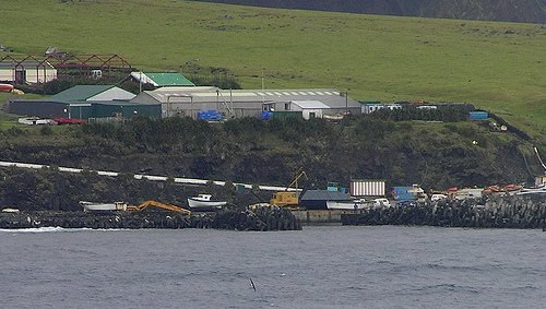
 The Settlement of Edinburgh now numbers just over 300 proud and hospitable people with only seven surnames among them. Through the islander’s veins flows the blood of English sailors from Nelson's fleet, Americans, Italians, Dutch and mulattos from St Helena and South Africa. English is the native tongue, albeit a slightly strange, preserved Georgian dialect laced with a few early Americanisms.
  The sea around Tristan da Cunha is blue, and, in the summer, the sun is warm. The tableland above the cliffs is lush. Just above sea level the northwest corner of the island there is enough flat land to accommodate the Settlement. Southwestwards stretches space for grazing and the famous potato patches.
  Tristan da Cunha with its neighboring islands, Inaccessible and Nightingale, is an ornithologists dream with fourteen different types of petrel including the greater shearwater, the prion and the storm petrel; the rock hopper penguins; the yellowed-nosed albatross and the wandering albatross.
  The Settlement of Edinburgh has a distinct air of yesteryear about it, although it has all the modern conveniences of mains water, electricity and sanitation. There is a small but interesting museum, a craft shop, a swimming pool and a radio-station. There are old style local shops, and a large supermarket.


